Announcement
Exciting New Developments on TracPlus Cloud
In our continued effort to bring new, valuable updates to TracPlus Cloud that improve operational efficiency, we are happy to present temporal...
Enhance data control & sharing capabilities with our latest update. Experience improved UI, multiple asset sharing, & customizable data visualization.
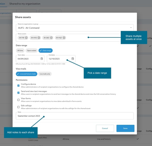
Temporal Sharing is an update to the current data-sharing capabilities used by many operators for contractual requirements. However, now you will have the capability to include date ranges within data-sharing. This means that you now have complete control over what data is shared with other organisations or groups.
Shares can be created (or existing shares edited) to be:
Any existing shares in your system will now be automatically classified as all-time shares unless edited otherwise.
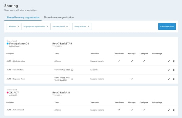
With the addition of Temporal Sharing, the UI has also been updated! But don’t worry, it is still similar enough so users who already manage sharing will have no trouble diving into our new features.
The improved interface has easy-to-use filtering controls that allow you to find shares both to and from your organisation.
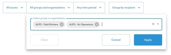
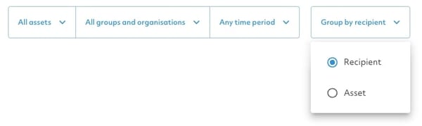
You can now list shares by asset or recipient further providing you with control over how you use your data.
Other features included to improve your experience include…
With the addition of temporal sharing, TracPlus continues to allow you to improve operational efficiency through reporting and other data-related features. With more to come, we will continue to provide this unparalleled quality to our customers.
Here are the key benefits that you will get to enjoy.
Additional Updates:
In addition to the release to of Temporal Sharing we are adding new viewing options to our Map views.
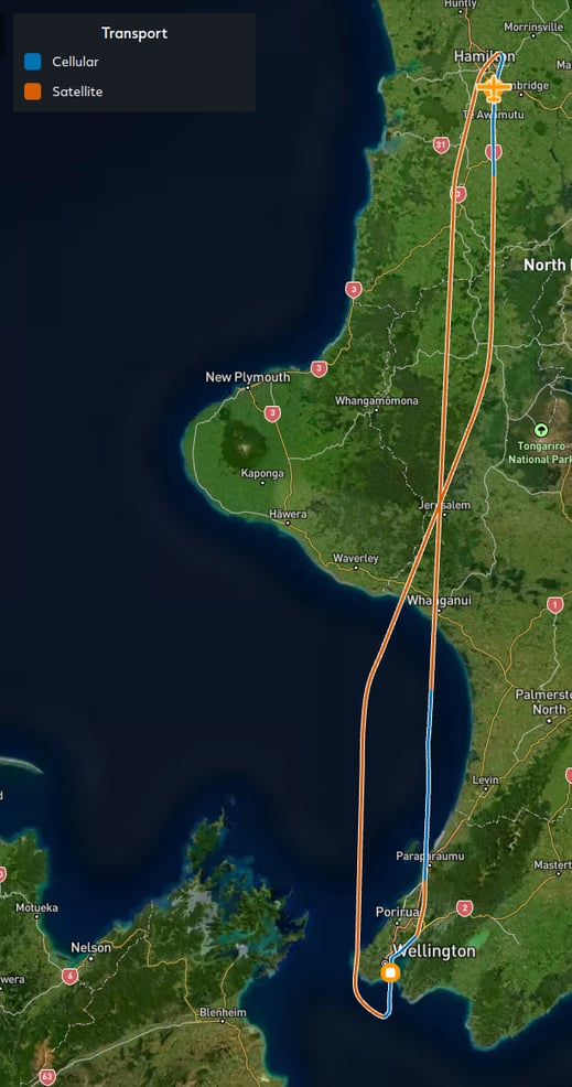
Functional Trail Colours, allow you to visualise data on the trail. You can colour it by speed, altitude, battery, latency and sat vs cell coverage. The values on the colour gradient are shown on the top tool bar.
New Map Views
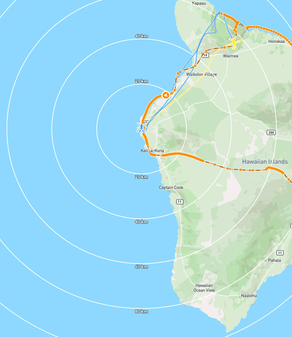
Distance rings, which show the distance to each asset, you will only be able to see these when an asset is in flight.
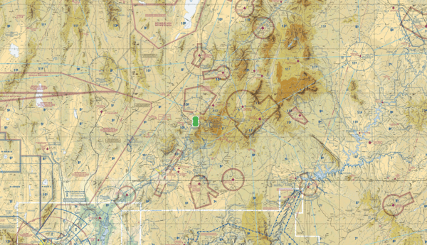
SkyVector VFR and IFR (Lo and Hi) Maps have also been included in this release. These map views are designed for preflight and enroute flight planning for IFR/VFR flights.
These are just the latest additions to TracPlus Cloud, we are continually adding new features and refining the platform. Get in touch with our team to find our how TracPlus can take your aerial operations to the next level.
In our continued effort to bring new, valuable updates to TracPlus Cloud that improve operational efficiency, we are happy to present temporal...
TracPlus was founded in 2007 by Chris Hinch after a tragic event to support helicopter pilots. It enables operational data sharing with first...
We emphasize being hardware agnostic, a key feature of our platform. In this blog, we explore what it means sharing valuable insights on this topic.