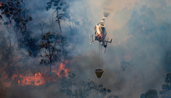
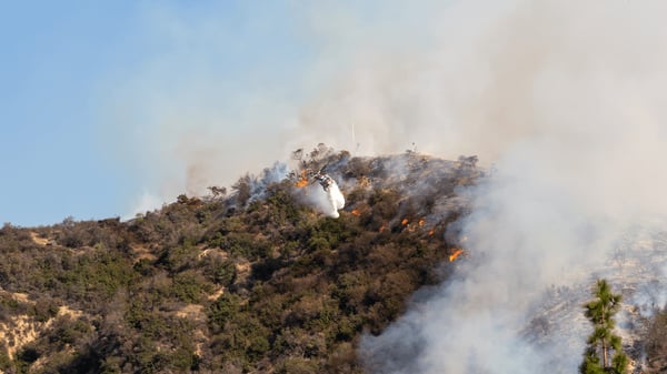
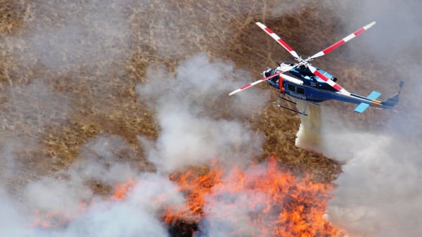
It's becoming increasingly common to hear how global warming is causing wildfire seasons to become longer, more unpredictable, and more destructive. This means that the need for well-informed, data-driven, strategic operational responses to wildfires is more important than ever. But how do top aerial firefighters actually do it?
This blog covers the content from our webinar in December. In this webinar, representatives from Flightcell and TracPlus discussed the services they offer, their benefits, and how top aerial operators like Kestrel and CAL FIRE are able to optimize their firefighting operations while also meeting mandated reporting requirements through these services.
How the Flightcell DZMx is Improving Operational Efficiency
To start off the webinar, Flightcell Director, James Mace introduced Flightcell and their product, the DZMx. Flightcell has been involved in the communications and tracking industry for over 20 years with a strong focus on public safety. Because of this, they’ve naturally been involved with aerial firefighting for the past 10 years. With operations in Australia, North America and Europe they have vast aerial experience.
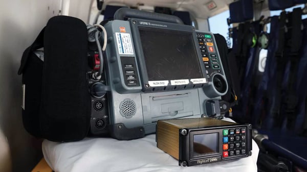
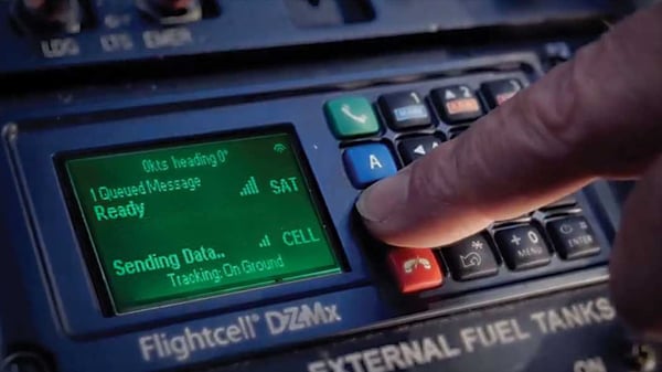
The DZMx is one of Flightcell’s premier products, which is fully integrable with TracPlus and provides numerous benefits:
- High definition GPS asset tracking
- 15 second low latency pings
- Night vision user interface
- Bluetooth connection with a cellphone
- Lightweight
- Comprehensive positional data recording
- Automatic rapid descent reporting directly to TracPlus cloud
- Flight event reports
- Telemetric data recording
Overall the Flightcell DZMx is invaluable because it allows aerial firefighting operators to access information that will allow them to better maintain, manage and synchronise their fleets. This will then allow for the improved operational response we always talk about.
NAFC and USFS both also have extremely strict mandates around data. Together with TracPlus as a monitoring and reporting platform, the DZMx is capable of meeting these mandates.
Click here for more detailed information on the Flightcell DZMx
How TracPlus Makes it Easier Than Ever to Monitor and Evaluate Operations
Next up, TracPlus CRO Todd O’Hara briefly introduced himself before discussing the benefits TracPlus provide that make the platform invaluable to aerial firefighting organisations like CAL FIRE and Kestrel.
TracPlus sets itself apart on account of the sheer amount of data operators have access to, and the ability to view and interpret that data. The data that can be recorded can range from altitude, speed, and coordinate data to the latency on a ping or whether the data came from cellular or iridium tracking. Our cloud-based platform, TracPlus Cloud, also allows for other features such as intelligent tracking and automatic flight leg detection.
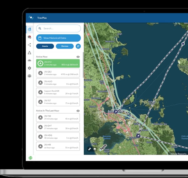
TracPlus also hosts a wide variety of other features as listed below:
- Secure and robust TLS security
- ETA tool
- Daily flight summaries
- Automatic alerts
- Monitor multiple assets through split screens
- Highly customizable base map with KML overlays
- Two way satellite messaging capabilities
- Exportable data through CSV and KML
- Hardware agnostic and fully integrable
Overall, TracPlus Cloud is capable of collecting all of the comprehensive data sent by the DZMx unit and then allows operators to interpret this data in an easy, understandable way. This kind of service allows for effective decision-making in high-pressure situations, which ultimately saves lives.
Click here if you want to learn more about the features of TracPlus Cloud
How CAL FIRE uses the TracPlus & Flightcell solution
CAL FIRE has a diverse fleet of over 50 strong with a mix of fixed and rotary wing assets. With the strict USFS guidelines and mandates around data, CALFIRE needed a comprehensive, accessible solution. This is what TracPlus and Flightcell were able to provide. Partnering with TracPlus and Flightcell in 2017, the DZMx meets all the required data mandates, sending all data to the USFS AFF platform via TracPlus’s reporting engine in real-time. Now the CAL FIRE fleet is always connected and monitored no matter how extreme the operational situation they find themselves in, with secure access to a common operating picture.
The DZMx also records advanced context info such as engine starts, takeoff, and water fill/drop events. All these features provided by TracPlus and Flightcell have allowed CAL FIRE to respond to critical wildfire situations in the most effective, well-organised manner possible.
How Kestrel Aviation uses the TracPlus & Flightcell solution
Kestrel has been partnered with TracPlus and Flightcell since 2012, when the fist DZMx unit became available. That unit is still reporting today, 11 years later. Kestrel receives all the same contextual data as CAL FIRE in order to ensure they make the most well informed decisions possible. However, all of the Kestrel data is sent directly to the ARENA network, NAFC’s nationwide monitoring system. All the data received by the ARENA network comes via TracPlus where it is integrated into a single output. In fact, TracPlus is the sole provider of tracking data for the ARENA network because of our ability to take multiple data streams from up to 59 different types of devices and convert them all into one standard output in real-time. This allows organisations like Kestrel to operate as effectively as they can with other aerial wildfire operators, even if they are using different devices or networks.
The Future of Data in Wildfire
The final part of the webinar was characterised by the question, “How do you see data impacting the future of firefighting going forward?”. Both James and Todd gave their own answers but both can be summarised as having the same key points.
- Wildfire seasons are getting worse globally
- Longer seasons are resulting in bigger fires
- Bigger fires cause more destruction leading to loss of more money and life
- Expensive assets are having to be deployed to fight expensive fires
- We can no longer expect to ‘brute force’ a wildfire into submission
- There’s more need than ever for more effective, data driven decision making
Both answers came back to the points around data-driven decision-making in aerial wildfire combat. In this new day and age, real-time data is absolutely critical to suppressing wildfires efficiently. Without it, organised and effective responses cannot be played out, and wildfires will continue to cause more death and destruction.
There was also a contractual convenience element to the future of data in wildfire that was mentioned. TracPlus and Flightcell are capable of recording and reporting flight data which accurately records airtime. This has the ability to streamline the billing process for contracted aerial units as they will be able to automatically export airtime data and use that when charging out.
If you wish to learn more about this topic, have a look at our free webinar where the topics discussed are delved into more in-depth, by experts.