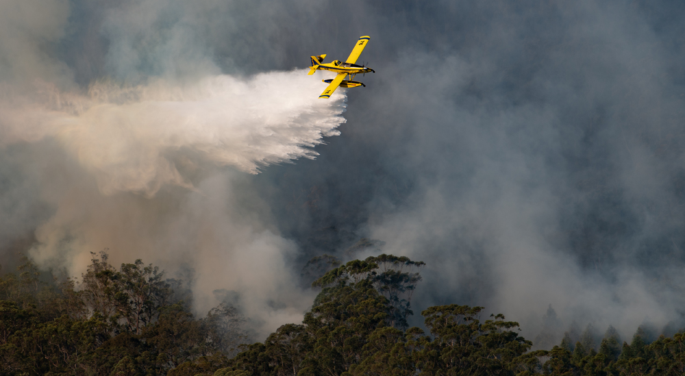
The day after a big incident, the questions start. Was the air worth what it cost? Why wasn't a tanker available when it was ordered? Did the contractor deliver what the contract paid for? Why won't the billing reconcile? They come from oversight, from finance, from the media, sometimes from an inquiry, and underneath they are the same question: what did the aircraft actually do, and how do we know?
Most agencies can tell you where the aircraft were. Far fewer can tell you what they did, in a form that survives being questioned. Aerial firefighting is the most visible and most scrutinised part of the fire response, and the part with the least structured data behind it.
To find out what its aircraft were actually achieving, the U.S. Forest Service put people in the air to watch. Between 2015 and 2018, observation teams flew over active fires and recorded what each drop did, by hand. They logged 27,611 of them across 270 fires.¹
The hardware has moved on since. The question has not. What each aircraft did, when, and why is still not something many organisations can pull from their own records.
That is a US example, but the pattern is not only American. Agencies across Europe and Australasia run much the same way. The skill and experience of the people doing the work is usually enough to run an incident. It is not enough to explain one.
Bigger budgets, harder questions
In 1985 the United States spent $239.9 million on federal wildfire suppression.² By 2021 that had reached $4.389 billion. The wider federal wildfire budget is larger still: Forest Service and Interior appropriations for wildland fire management came to about $7.3 billion for 2025.³
Money on that scale draws questions, and they are fair ones. Did the extra aircraft change the outcome? Which resources earned their cost? What should we contract more of next season? Hours flown answer none of them.
Some of that evidence is still gathered by hand: timed on a tarmac, written on a form, retyped into a spreadsheet. The intent is good; the accuracy does not follow. Records like that can tell you what an aircraft cost. They cannot tell you what it achieved.
The gap is not collection
Much of this data already exists. The equipment on most firefighting aircraft records position, speed, and altitude, and, depending on what is fitted, the volume and type of every drop. The problem is not what is captured. It is that what is captured too often lands somewhere it cannot be searched, compared, or defended.
A stream of positions is not an operational record. It can show that an aircraft flew a low pass over a ridge. It cannot show why that ridge, what the aircraft did while it was there, or whether the pass was flown within safe margins. That is the difference between tracking and a record. Tracking tells you where. A record tells you what happened, and it holds up when someone disagrees with the answer.
Agencies rarely say they need more data. What they say they need is a way to use the data they already hold.
One record, three time horizons
A record built this way earns its keep three times.
During an incident, it shows the air campaign as it happens: where each aircraft is in its cycle, what has been dropped and where, and where the gaps are.
After an incident, it answers the questions that arrive the next day. The after-action review starts from evidence, not recollection. The billing stops being an argument. When an official, an investigator, or the public asks what happened, the answer is the same every time it is asked.
Before the next one, it becomes a preparedness tool. Knowing which missions crews have actually flown, how often, and in what conditions is a more honest measure of exposure than a flight-hour threshold.
It goes further than explaining the past. Hazard, weather, and fuel can be layered onto the same record to show where risk is building, and setting the fleet against that turns it into a decision: which ground carries the most risk, which aircraft can reach it, and what they can deliver when they arrive. That last part comes from the record itself. What an aircraft has actually done across a season is the best guide to what it can do tomorrow. A positioning decision made before a fire starts is worth more than any efficiency found after it.
This is already happening
None of this is theoretical. CAL FIRE, the New South Wales Rural Fire Service, Australia’s National Aerial Firefighting Centre, and Fire and Emergency New Zealand are among the agencies already building the operational record into how they run and account for their aviation.
Every agency can say where its aircraft were. The ones that can also say what those aircraft
did will spend less time reconstructing last season and be better prepared for the next one.
Sources
¹ USDA Forest Service, Fire and Aviation Management. Aerial Firefighting Use and Effectiveness (AFUE) Report. Washington, DC: USDA Forest Service, March 2020. https://www.fs.usda.gov/sites/default/files/2020-08/08242020_afue_final_report.pdf.
² National Interagency Fire Center. “Suppression Costs.” Statistics. Accessed July 27, 2026. https://www.nifc.gov/fire-information/statistics/suppression-costs.
³ Riddle, Anne A. Funding for Wildfire Management: FY2025 Appropriations for Forest Service and Department of the Interior. CRS In Focus IF13102. Washington, DC: Congressional Research Service, September 12, 2025. https://www.congress.gov/crs-product/IF13102.