But how does this relate to the fight against naturally occurring bushfires?
Spearheading this research project is the American Department of Homeland Security’s Science and Technology Directorate. Their specialized team have been set to work on a program to see how the internet of things technology can mitigate the threats associated with wildfires.
The Wildfire Problem
How IoT technology will be used
What can be done with this data?
The Wildfire Problem
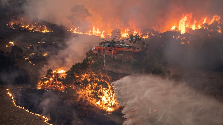
The United States of America had over 52,000 wildfires in 2019. The associated destruction caused by the huge amount of fire activity (deaths, property loss land destruction) is the driving force behind this research project. The department of homeland security was approached by the Federal Emergency Management Agency (FEMA) to look into how research and development could be implemented to combat a big issue developing in the country.
Early fire detection and live tracking of fire movements are the big focus points in this research partnership. The opportunity to create devices with the ability to track fires more precisely and in near real-time offers great value to firefighters, and even those evacuating fire-affected areas.
Watching the generation of wildfires, their movement patterns and growth rates are all important pieces of information that will be available, with the data available for widespread use to keep people safe and limit the destruction of these events.
How IoT technology will be used
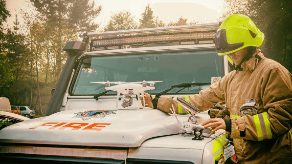
Similar to what has been seen in flood-affected areas, the technology is integrated with the internet to allow full access for emergency providers. The project will look into the deployment of situational sensors, which can relay a live feed of fire activity. In addition to fire sensors, there’s potential to use unmanned aerial vehicles (UAV’s) and new satellite observing systems to track the movements of a wildfire. Modern tech, in combination with live satellite, means a high refresh rate, providing accurate information that can be transmitted to emergency services and rescue providers.
“Within a 10 minute period of this information being collected, it is able to be transmitted to the forest responders and emergency staff that are on the ground preparing to battle the blaze.”
Sensors will be situated on the ground or at a facility where authorities have an undisturbed line of sight or better viewing angles. Having a high number of open detection area sensors will aim to produce a more accurate result.
Sensors will have the ability to detect changes in the surrounding atmosphere, identifying conditions where fires are present, meaning they are accustomed to being able to detect the conditions best suited for wildfires.
The capability of these sensors gives them the have the opportunity to detect many measures that are reflective of wildfires fires and/ or conditions that are suitable for a wildfire. Measures include smoke, carcinogens in the air, humidity conditions, high temperatures all factors that are key identifiers for influencing wildfire activity.
What can be done with this data?
When researching existing firefighting structures, FEMA found that an underlying issue of their processes was not having the ability to forecast and track the movement of fires when in critical areas. This information is critical for emergency services and evacuation planners for assembling and optimizing evacuation routes and treatment plans.
"With the implementation of this new technology, situational information that is collected in real-time can be paired with artificial intelligence, and other machine operated knowledge systems to generate predictive analytics for how a fire is moving/changing."
This information is then used in partnership with emergency operators with the end goal of saving more lives and preventing property and forest loss.
Testing of these systems is beginning to roll out across very small test groups using existing relationships with George Mason University and SETI, with adaptations and new versions aiming to integrate with the National Weather Service and their associated GOES satellites.
Using IoT is a very interesting and creative solution to firefighting. The TracPlus team is looking into the developments of these systems and how they can be adapted globally to make procedures for emergency providers safer and more efficient.
Would you like to transfer data more easily? Demo our software and see for yourself how user-friendly TrackPlus is.