1. AFDAU-T1
2. FireMapper
3. RockDASH
4. NASA Powered Fire Modelling and Forecasting
5. RockSTAR
1. AFDAU-T1 - Simple, Accurate Data Collection For Reporting and Billing

AFDAU-T1 is the world's first automated bucket calibration and digital data collection tool. Launched in 2020, in Sydney, the innovative unit records accurate data information about water bucket operations, including volumes collected/dropped, engine starts/stops and aircraft takeoffs/landings.
Not only is the unit an accurate collection tool for firefighting data, but the data that AFDAU-T1 captures is required for firefighting contracts under certain government agencies, such as Australia’s National Aerial Firefighting Centre (NAFC). In simpler terms, AFDAU-T1 collects reporting data which ensures that all accrued revenues can be paid out in full.
Tested by leading aerial firefighters across Australia, AFDAU-T1 is already proving itself a valuable tool in the fixed-wing and rotary aerial firefighting markets with aerial firefighting leaders, United Aero Helicopters, sharing: “We're going to implement them across our whole fleet. It's a no-brainer for us.”
Explore Now
2. FireMapper - Intelligent Fire Analysis
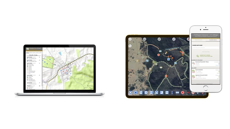
FireMapper, by Fire Front Solutions, is a fully-featured mapping solution designed for emergency services and land management, using the Australasian All Hazards Symbology and compatible with leading GIS solutions and protocols, FireMapper can integrate with corporate systems in real-time, including TracPlus.
Offering a comprehensive list of "Out-of-the-box" features for sharing spatial data in real-time, in addition to their ‘Enterprise Solutions’ offering, FireMapper can further tailor functionality and integration to satisfy the requirements of all fire agencies.
FireMapper delivers an agency-wide capability for managing mapping data and enhancing operational situational awareness. It is designed to be used on the fire ground and in the air by first responders and incident management staff. FireMapper can operate as a fully hosted solution, or on agency owned infrastructure, or a combination of both, providing significant flexibility in deployment approach, security, availability and functionality.
FireMapper allows users to share a common set of maps, as well as real-time tracking of appliances, aircraft and user locations. Maps can be created and shared across an agency using specialised emergency and hazard symbology covering incidents, operations, aviation, assets and fire investigation.
3. RockDASH - Reliable and Affordable Vehicle Tracking

For the past decade, it has been common to find tracking hardware in aerial assets all around the globe. However, technology is now being adapted to fit all asset types within firefighting organisations, including fuel and fire trucks – further connecting those fighting fires both on the ground and from above.
In order to better coordinate your ground-based firefighting vehicles, advanced technology inside the RockDASH uses satellite and cellular networks to create a reliable, yet cost-effective, communication and location service for vehicles. Beyond tracking, RockDASH can also send emergency and SOS notifications, if your team is in trouble.
Creating a connected ecosystem throughout your entire firefighting operation means no crews or assets are left behind on the frontline. Making sure your people and vehicles are accounted for is the first step in the right direction for operators. Find Out More.
4. NASA Powered Fire Modelling and Forecasting
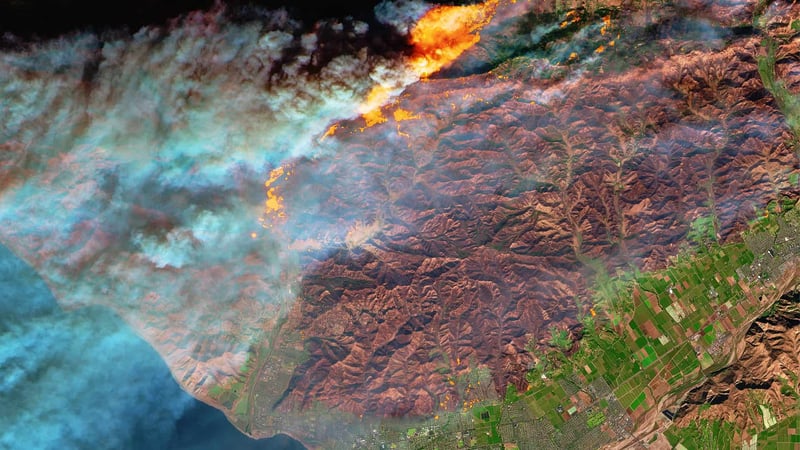
Fire forecasting models, like weather forecasting models or climate models, use mathematical equations to represent real-world processes such as winds, cloud formation, and the growth and spread of fires and smoke.
NASA and other satellite companies are now developing their partnerships to develop smart analysis of weather patterns, such as the WRF-SFIRE model. A “coupled” fire-atmosphere model, the system simulates not only the fire and weather, but the evolving interactions between the two.
The model enhances the widely used Weather Research and Forecasting model (WRF), combining it with a module simulating how fire spreads and interacts with local weather – allowing agencies to physically see the activity, and trends of wildfire activity, all with the goal to further understand how a wildfire advances through the natural environment.
Data is king. We can’t go without information that helps us better predict the movements of these catastrophic events. Without data analysis, there is simply no way we can match the intensifying fire seasons that the world is seeing.
5. RockSTAR - Rugged Handheld Connectivity
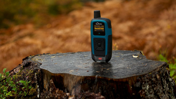
The Australian Communications and Media Authority (ACMA) reported that 1,390 telecommunications facilities were impacted by the Black Summer bushfires, and in most cases, they went dark due to power outages. More than half of the telecommunications towers that did go down were off the air for over four hours, with an average outage of 3.5 days.
RockSTAR, by RockSEVEN, combines durability, long-lasting battery life and seamless connection to networks to create a monitoring and messaging tool that enables firefighters to remain in touch, even when cell towers are unavailable. Integrating with tracking and communication platforms such as TracPlus, ROCKStar allows incident managers to view all active personnel, in one place.
Tech needs to be usable when you need it most. Utilising Iridium satellite networks, RockSTAR presents a robust handheld solution for ground-based firefighters. RockSTAR enables constant contact for those on the frontline, when all else fails.
While the industry works to constantly improve fire response, modern technology like those highlighted above will provide firefighters access to a source of accurate fire data, and reliable means of communication.
As a modern technology provider, TracPlus will continue to work alongside firefighters worldwide, ensuring they remain safe while protecting our communities.
Try TracPlus for your firefighters, and see how our software can speed up your response time - talk to us today.