Detailed flight activity reports
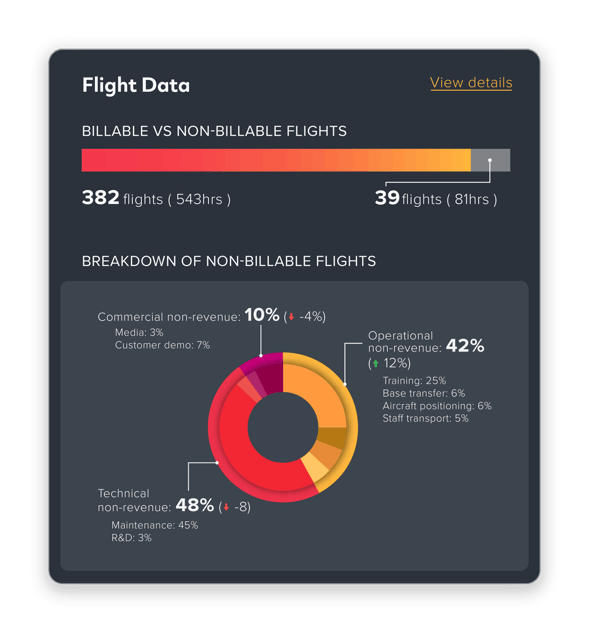
Access geo-referenced take-offs and landings, altitude and speed analysis, engine cycle tracking, and fleet trip summaries.
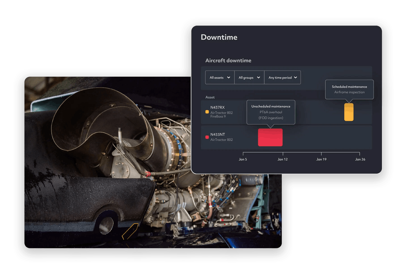
Optimize financial performance with insights into costs, resource utilization, and downtime, enabling smarter, data-driven decisions and better revenue protection.


Contracted aviation programs involve significant public expenditure, and the pressure on agencies to account for that spend is growing. For operators, the challenge runs the other way; without accurate flight data, billable time goes unrecorded and revenue walks out the door. FireFlyte changes that.

Improve financial oversight with detailed tracking of asset costs, inactive periods, and cost recovery. Gain a clearer picture of how resources are being utilized with our powerful features.

Access geo-referenced take-offs and landings, altitude and speed analysis, engine cycle tracking, and fleet trip summaries.
Understand the financial impact of downtime with detailed tracking of both controllable and uncontrollable factors. Monitor personnel availability and resource utilization to improve efficiency.
Make smarter financial decisions using detailed data insights to protect revenue, optimize billing processes, and avoid unnecessary financial losses.
Ensure precise billing by leveraging accurate financial data to reflect the true cost of operations, improving transparency and revenue protection.

Gain clear insight into operating costs and revenue for your contracts, allowing you to accurately report on contract specific margins.
Built on 20 years of TracPlus' experience in the industry, FireFlyte, powered by TracPlus, is designed to deliver deep insights into safety, finance, and operational performance for aerial firefighting agencies and operators. FireFlyte gives you a real-time view of aircraft, drops, and operations - so you can coordinate faster, respond with confidence, and maximize mission effectiveness.
OVER
of drops recorded in our platform in 2025.
OVER
of data processed annually, worldwide.
OVER
of global tracking and telemetry data.
Real-time tracking of aerial assets, their trajectories, and event data. Pilots and command centres have a real-time view of the aerial battlefield, ensuring each move is strategic and calculated.
Access to real-time data and analytics for swift decision-making. Incident Commanders can adjust their strategies in-flight, responding to evolving fire patterns and ground team updates.
Integration of aerial, vehicle, and ground-based tracking and firefighting event data from various systems. All units, irrespective of their tracking service provider, can be coordinated from a single hub, ensuring a unified response.
Advanced Additional Telemetry Unit (ATU) and real-time tracking solutions. Simplifies the task of meeting strict reporting requirements set by bodies like the US Forest Service and NAFC.
Continuous monitoring, automated alerts, and distress signals for aerial teams. Pilots operate with the assurance of being monitored, and help can be dispatched immediately in emergencies.
Accurate tracking of water pick-up and drop-off locations, including volume of water. Increases the efficiency and effectiveness of aerial water bombing operations.
Dual cellular/satellite connectivity with flexible tracking rates. Allows for efficient operations with no risk of disconnection, while optimising cost-effectiveness.
Ability to share aerial data with other firefighting entities. Facilitates a more comprehensive and collaborative aerial response, pooling resources and insights for a more effective firefighting strategy.

SAAMA Aviación is a specialized aviation company based in Chile dedicated to fighting forest fires with high precision and aerial water deployments.
"TracPlus meets all our expectations. Start-up, real-time tracking and liquid launches."
— Hugo Miranda, Operations Manager, SAAMA Aviación
This white paper examines the transformative role of Additional Telemetry Units (ATUs) and agency-level software like FireFlyte in meeting this need by enabling precise, actionable data collection and insights from aerial firefighting assets.
---Fighting-fire-with-data---ebookx.png)